
Day trip to Cap Reinga
Day 159 – Paihia, New Zealand
(It’s the 5th of November, so there are fireworks getting off everywhere tonight!)
I was a bit anxious this morning about the weather, since yesterday’s rain had cancelled, I was afraid it would reschedule today. But no, we had a beautiful day.
The bus was a bit late picking me up at the awful hour of 7:20 at the hostel (apparently three of our co-tourists went on the wrong bus), but we went on our merry way for a day of adventures.
We started by a stop in a Jurassic forest, with tree ferns and kauri trees. The driver gave us a running commentary during most of the day about the history and geology of the area we were passing through, it was interesting.
Kauri wood floats, and the trees grow straight and very tall, so they were an ideal resource for 19th century Europeans. The taller the tree grow, the best it becomes, as it sheds its lower branches and its trunk widens.
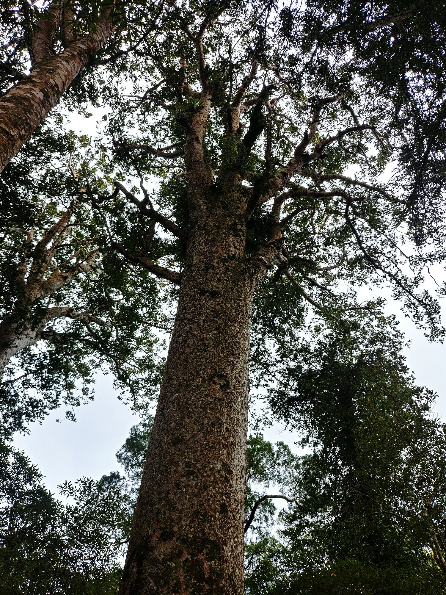
Puketi Kauri Forest – Kauri tree top
After a while though, they realized that it is a very slow growing tree (so the forests weren’t replenishing themselves), and its logging was stopped.
But further north, farmers digging trenches to change swamps into fields discovered two layers of forest buried underneath. These forests existed tens of thousands of years ago, but the kauri trees (laying down in the same direction, hinting at a natural disaster) could be dug out, dried, and are now used in the kauri wood industry.
We had 15 min to walk the short boardwalk that goes through the forest and around the trees. It can be short (and that’s the thing with organized tours, you have a limited time to do the activities).
We had a breakfast stop (second breakfast), then went on to Cap Reinga. It is the northern point of New Zealand (there is actually a spit of land getting further North, but it is not as accessible). Maori believes that when one dies, one’s soul goes to this cap, where the sea meets the sky, and the soul leaves the land there to get to the next life.
So it is a sacred place (and we are not supposed to eat there). It was absolutely beautiful, the sea was very blue, the sky had almost no clouds, and the vegetation had many luxurious shades of green.
This is where the Tasmanian Sea (West) meets the Pacific Ocean (East), and that is visible on some pictures through the white crests of waves meeting there.
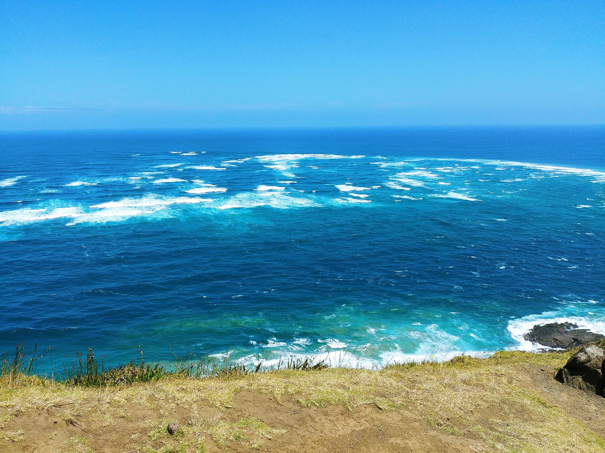
Cap Reinga – Tasmanian Sea meets Pacific Ocean
The nearby cap is named Cap Maria van Diemen, named by Abel Tasman after the wife of his Dutch East Indies Company boss (see picture on top). Now that may have come to be for different reasons, but I have my theory.
*Phone rings*
-“Abel here. Boss, that’s you calling?”
-“Yeah Abel, I need a favor. See, today it’s our marriage anniversary with Maria and I’ve forgotten. Again. I need to grovel and to come up with a very good idea to make up for it. So… seen any nice landmark lately?”
-“Sure, I have this amazing stretch of beach, three small rocky islands, and hum… the northern cap of whatever landmass I’m currently following.”
-“Great, that’s perfect! Give the cap my wife’s name, we’ll put a lighthouse on it one day, and I won’t sleep on the couch tonight.”
-“Sure thing boss. See you in the Netherlands when I come back!”
There is a comfortable walk from the carpark to the lighthouse.
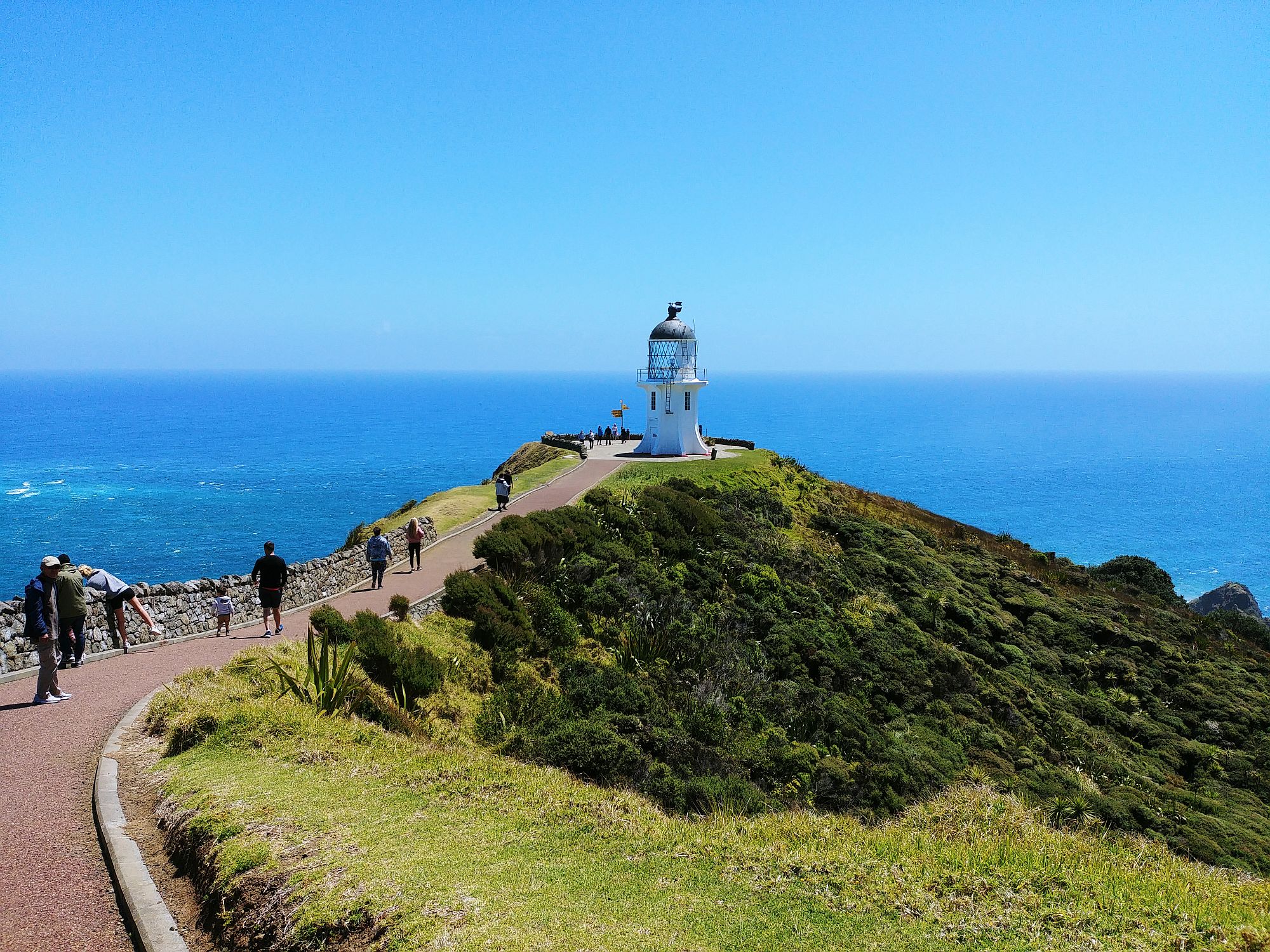
Cap Reinga – The lighthouse
We boarded the bus to go on on our trip. We went surfing down dunes on sandboards!
The dunes are very steep -no surprise there-, to access them we drove in a stream that is quicksand… so the driver had to be careful! But she took us safely to our surfing dune.
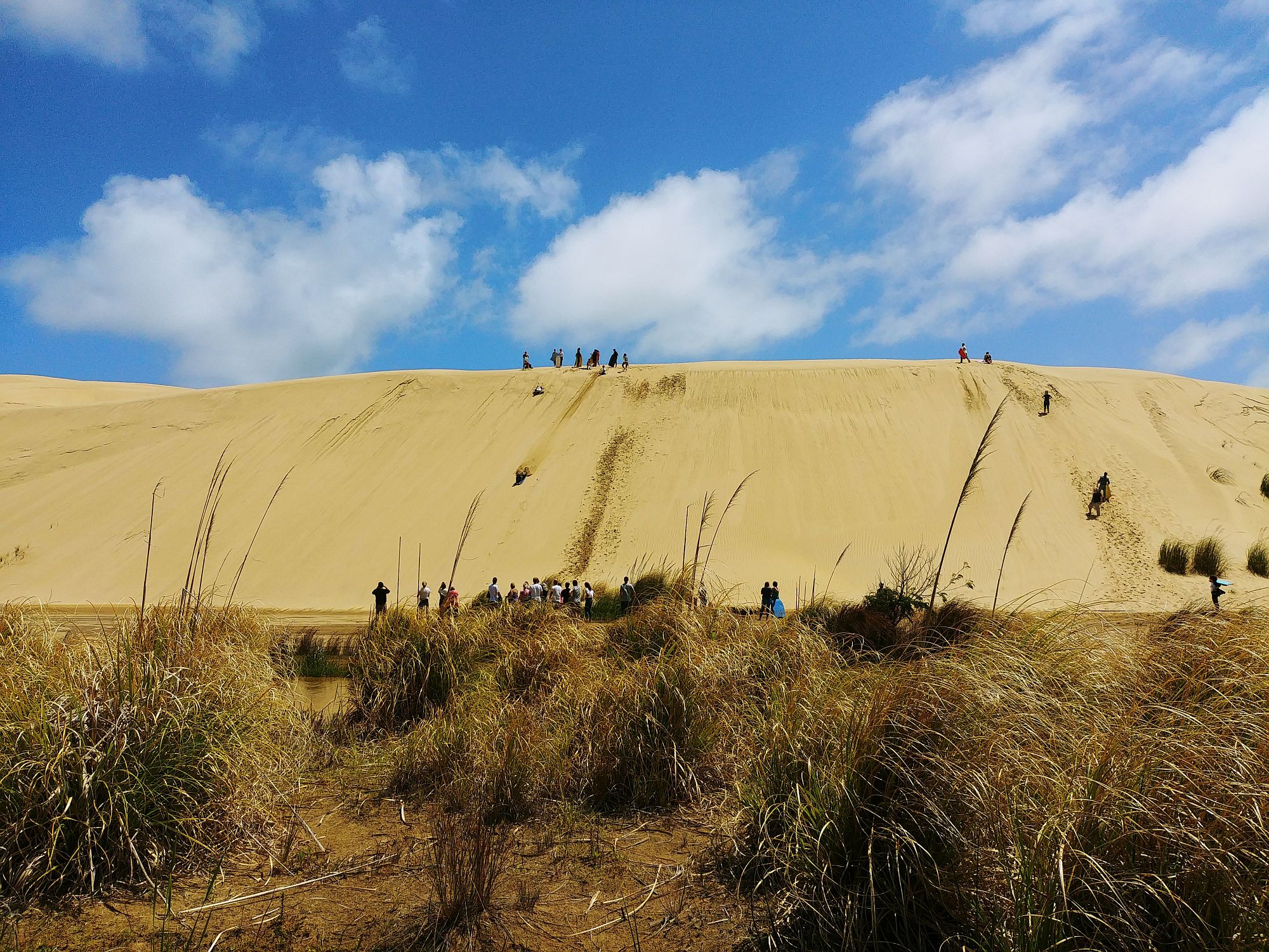
Sandboarding
The stream is at the bottom if the dune, and the trick is to pick enough speed not only to skip on top, but to go as far as possible. The stream is less than 10 cm deep on most places, so there isn’t any risks of drowning… but you end up wet and sandy! I’ll admit to making only one run, the perspective of going back up too daunting.
After a few runs, we went on our merry way to Ninety Mile Beach. We drove right on the beach, stopped for the obligatory pictures, being careful of other traffic (the speed limit on the beach is 100 km/h), and went back aboard.
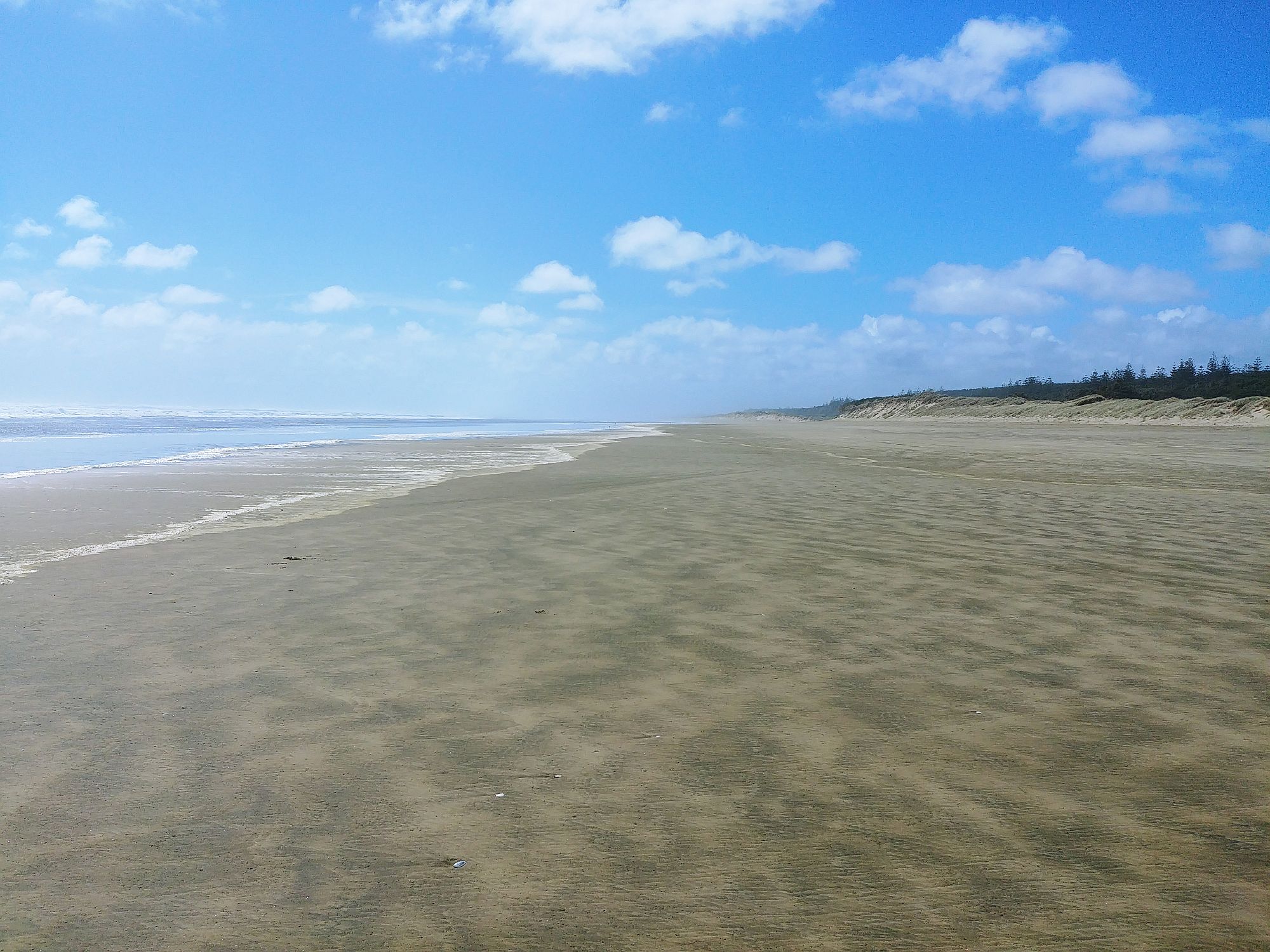
Ninety Mile Beach
Apparently the beach isn’t 90 miles long, but well. It is long enough. (In the time before there were roads, you would drive the cattle to the market on this flat beach. Since cattle usually walk 30 miles a day, and it took three days, the math was easy. But cattle doesn’t walk as fast on sand as on firm land, which they didn’t take into account…! So it’s around 56 miles, or 90 km.)
Our next stop was a kauri wood gallery, with beautiful kauri carvings, some utilitarian (kitchen implements…), some decorative. A huge section of tree trunk, in which a staircase has been carved, links the ground floor to the second.
Our last stop was a fish & chips restaurant, where we ate the catch of the day, battered and fried, for our early tea. (Tea is the meal you eat at the end of the day.)
I sat in the bus next to a Dutch woman, and we had a pleasant talk along the way/day!
2 Comments
Comments are closed.
Quelle beauté que cette pointe, quel que soit son nom! Et j’aurais bien voulu te voir en sandboard!
TU as dû passer une très bonne journée!
Je ne connaissais pas ces kaoris: ceux que tu as vus sont-ils vénérables? IL semble qu’ils aient failli disparaître…
Les kaoris de mes photos sont “jeunes”, ils ont 200-300 ans.
Je n’ai pas pu prendre de photo de moi en train de faire du sandboard, ce n’est pas recommandé de garder son appareil dans la descente, et c’est un peu rapide pour demander à qqn de prendre la photo…! 🙁
Mais oui ça a été une très bonne journée! 🙂